Wyoming's transmission network
Map data as of 20 October 2026.
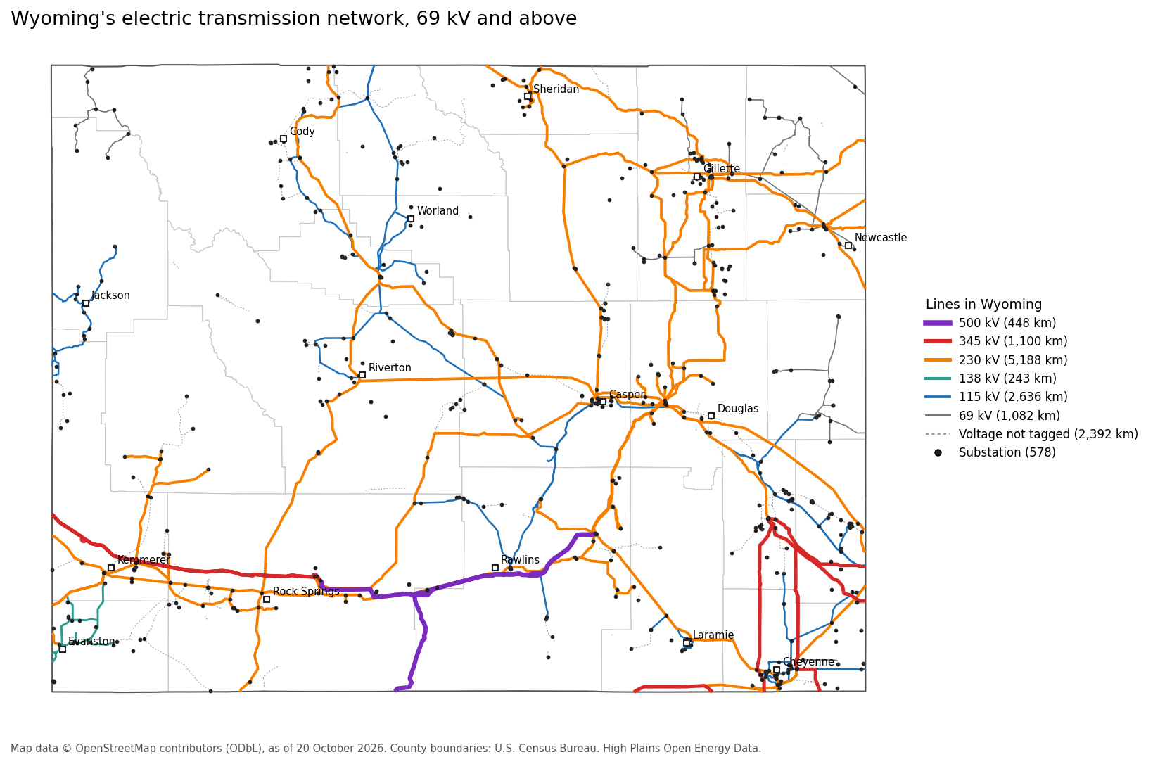
A map of the power lines and substations in Wyoming at 69 kV and above, built entirely from public data. The lines and substations come from OpenStreetMap, which volunteers map and which is detailed in Wyoming, though neither complete nor official.
Line length by voltage
| Voltage | Length in Wyoming (km) |
|---|---|
| 500 kV | 448 |
| 345 kV | 1,100 |
| 230 kV | 5,188 |
| 138 kV | 243 |
| 115 kV | 2,636 |
| 69 kV | 1,082 |
| Voltage not tagged | 2,392 |
| Total | 13,090 |
The map shows 1,799 line sections and 578 substations. Lengths are measured inside Wyoming only; lines that cross the state line are cut at the border. About 2,392 km of lines carry no voltage in OpenStreetMap and are drawn as dashed grey lines.
Downloads
- wyoming_transmission_lines_osm.geojson: every line section, with its OpenStreetMap ID, name, operator, voltage tag, voltage class, the counties it crosses and its length in Wyoming.
- wyoming_substations_osm.geojson: every substation, with its OpenStreetMap ID, name, operator, voltage tag and county.
- The map above, as an image.
GitHub displays GeoJSON files as an interactive map: open either file in the repository to zoom in and click on any line or substation.
Licence
Map data © OpenStreetMap contributors, available under the Open Database Licence (ODbL). The two GeoJSON files are derived from OpenStreetMap and are released under the ODbL, not under this site's CC-BY-4.0 licence. County boundaries are from the U.S. Census Bureau's cartographic boundary files.
Corrections to lines or voltages are best made in OpenStreetMap itself, where they benefit everyone; they will appear here when the map is next rebuilt.